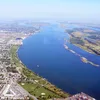
Matapedia River
88.2 km | 54.8 mi
Länge kann von der offiziellen Messung abweichen!
Kategorie 2
Diesen Fluss auf der eigenen Website einbetten
Wikipedia Matapedia River
The Matapedia River (French: Rivière Matapédia, pronounced [ʁivjɛʁ matapedja]) is a river in the Matapedia Valley in the province of Quebec, Canada. It runs on 65 kilometres (40 mi) from Matapedia Lake down to the village of Matapédia where it empties into the left bank of Restigouche River on the provincial border of New Brunswick.
This freshwater course forms a natural border between the administrative regions of Bas-Saint-Laurent and Gaspésie-Îles-de-la-Madeleine. The river is a North South divide in the Notre Dame Mountains that characterize the relief of the Gaspé Peninsula. The Matapedia River basin drains an area of about 3,900 kilometres (2,423.35 mi). Matapedia River is often called the Salmon Capital .
From the South side of Matapedia Lake and going to the South, the route 132 along the river goes on its entire length by the East bank.
The Canadian National Railway passes South of Matapedia Lake continues on the West bank of the river in Causapscal where the bridge at South of the village made the railway cross on the East bank.
The track then continues South on 8.5 kilometres (5.3 mi); then passes again in the West Bank via the railway bridge located at 1.1 kilometres (0.68 mi) North of the confluence of the creek Doyle.
The railway then rest on the West bank up to the railway bridge at the confluence of the Rivière du Moulin (Matapedia River).
From there, the last railway segment passes through the Eastern shore, up to the confluence of the Matapedia River.
Quelle: Wikipedia https://en.wikipedia.org/wiki/Matapedia_River
This freshwater course forms a natural border between the administrative regions of Bas-Saint-Laurent and Gaspésie-Îles-de-la-Madeleine. The river is a North South divide in the Notre Dame Mountains that characterize the relief of the Gaspé Peninsula. The Matapedia River basin drains an area of about 3,900 kilometres (2,423.35 mi). Matapedia River is often called the Salmon Capital .
From the South side of Matapedia Lake and going to the South, the route 132 along the river goes on its entire length by the East bank.
The Canadian National Railway passes South of Matapedia Lake continues on the West bank of the river in Causapscal where the bridge at South of the village made the railway cross on the East bank.
The track then continues South on 8.5 kilometres (5.3 mi); then passes again in the West Bank via the railway bridge located at 1.1 kilometres (0.68 mi) North of the confluence of the creek Doyle.
The railway then rest on the West bank up to the railway bridge at the confluence of the Rivière du Moulin (Matapedia River).
From there, the last railway segment passes through the Eastern shore, up to the confluence of the Matapedia River.
Quelle: Wikipedia https://en.wikipedia.org/wiki/Matapedia_River