Rivermap EN Reuss
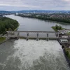
The Reuss rises high in the Gotthard massif and covers roughly 164 kilometres, first carving through the steep valleys and narrow gorges of the canton of Uri before emptying into Lake Lucerne near Flüelen, where it forms a varied delta with swimming islands and shoreline paths. Leaving the lake at Lucerne, it continues as a broad lowland river through extensive alluvial plains, natural banks and clusters of islands until it joins the Aare. Well-maintained trails along its course invite hiking and cycling, while the calmer lower reaches provide excellent conditions for canoeing and kayaking, river surfing at weirs, swimming and picnicking amid unspoilt nature.