Rivermap EN Gandak / गंडक / Gandaki / Narayani / Kali Gandaki
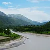
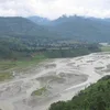
The Gandaki River, known in its upper course as the Kali Gandaki, originates near the Tibetan border in the Mustang region of Nepal and carves a dramatic southward path through the central Himalayas. Geographically it is defined by the extraordinary Kali Gandaki Gorge, one of the deepest on Earth, where the riverbed lies more than five thousand meters below the flanking peaks of Dhaulagiri and Annapurna. From high arid plateaus the river descends through steep, narrow canyons into broader mid-hill valleys before emerging onto the fertile Terai plains, where its channel system becomes braided and multi-threaded, forming shifting side channels, sandbars and temporary islands that continually reshape the landscape. Along its banks traditional irrigation channels draw water into terraced fields, linking the river’s flow to the surrounding agricultural geography. For leisure the river and its valley offer outstanding opportunities: multi-day rafting and kayaking expeditions navigate lively class III to IV rapids through remote gorges with camping on sandy beaches, while classic trekking routes such as sections of the Annapurna Circuit follow the river corridor, revealing changing ecosystems from alpine desert to lush forest and providing access to hot springs and panoramic mountain vistas.