Rivermap EN Awatere River (Marlborough)
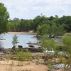
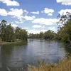
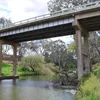
The Awatere River traces a roughly 110-kilometre course along a straight tectonic fault through the dry Marlborough hinterland of New Zealand. Rising in the high inland sources of the Inland Kaikōura Ranges near Molesworth, it flows northeast between steep mountain chains and broad river terraces down to the coast near Seddon on Cook Strait. The landscape shifts from clear, stony upper reaches with alpine vistas to silty braided lower sections bordered by vineyards and high-country stations. Leisure pursuits centre on brown trout fishing in the clearer upper stretches, packrafting and kayaking on moderate whitewater runs, as well as hiking, mountain biking and hunting in the surrounding ranges with access to peaks such as Tapuae-o-Uenuku.