Rivermap EN Duncan River (British Columbia)
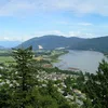
The Duncan River winds for approximately 206 kilometres through the West Kootenays of southeastern British Columbia. Rising near Mount Dawson on the edge of Glacier National Park, it flows southward along the glacial Purcell Trench, flanked by the Selkirk Mountains to the west and the Purcell Mountains to the east. Along its course it passes through the expanded Duncan Lake reservoir, meets the Lardeau River, and empties into the North Arm of Kootenay Lake. The scenery shifts from steep forested slopes and glacier-fed streams to broad wetlands and riparian flats rich in wildlife. The lake and calmer river stretches offer excellent fishing for kokanee, rainbow trout and bull trout, together with boating, paddling and camping at accessible shoreline sites, while the surrounding valleys and peaks invite hiking and wildlife viewing.