Rivermap EN Weiser River
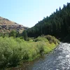
The Weiser River rises in the Seven Devils Mountains of northern Adams County in western Idaho and winds roughly 103 miles southwest through mountainous foothills and narrow canyons between the Cuddy Mountains and the West Mountains, passing Council and Cambridge before entering the broader Weiser Cove and joining the Snake River near Weiser. Its course descends from high elevations of around 8,000 feet in the Payette National Forest through ranching valleys and lava-rimmed canyons down to about 2,090 feet. Along its banks the 84-mile Weiser River National Recreation Trail provides excellent opportunities for hiking, cycling, and horseback riding across changing scenery from evergreen forests to sagebrush steppe and river corridors rich in wildlife. In spring the Class II to III rapids invite rafting and kayaking, especially on the Midvale stretch, while anglers pursue trout and bass year-round and simple camping spots allow immersion in the surrounding wild landscapes.