Rivermap EN Malheur River
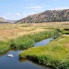
The Malheur River winds approximately 190 miles through the varied terrain of eastern Oregon. Rising in the southern Blue Mountains within the Strawberry Mountain Wilderness of the Malheur National Forest, it travels across high desert country, through steep volcanic canyons reaching depths of up to 1,000 feet, and over open plateaus before joining the Snake River near Ontario. Protected wild and scenic stretches feature rugged cliffs, stands of old-growth trees, and remote riverbanks. These settings offer excellent opportunities for trout fishing, hiking along canyon trails, horseback riding, and camping in peaceful, undeveloped surroundings.